Friday, October 29, 2010

Day 47, 48 & 49 - Salt Lake City, UT -> Idaho

Wednesday, October 27th, 2010

I boondocked for the night in Orem, UT in a Wal-Mart parking lot. Wal-Mart is one of the few places that will let RV’ers use their lot overnight to park and sleep. I know I’m not driving a big, fancy RV, but my Subaru has been my home on wheels for the past month and a half. There were no dark corners to take cover from the bright parking lot lights so I strategically nestled my car close to a tree on one side to shade the driver’s side. A sun visor blocked out the front windshield and a blanket resting over the headrests of the front seats blocked any light coming in through from the driver and passenger windows. Using my telescoping ski/hiking poles, I was able to temporarily fasten a towel across the back window and a dark sheet along the passenger side of the car. Fortunately, I have been able to create a very comfortable and dark sleeping environment in my car, my tiny RV. This will be quite helpful for when the temperatures really start to get cold and I no longer want to sleep in a tent.

I woke up in the morning to find a few inches of snow on the car. It wasn’t a lot, only about two inches, but it was enough to put a smile on my face. I ordered a coffee from McDonalds and ate a bagel from my food pantry, which is just a fancy name for my cardboard box and made my way to Salt Lake City, Utah.

I think it was only about 30 miles but I didn’t feel like driving those last 30 miles last night. I have an old friend, Eric, who has been living in Salt Lake for the past 7-8 years now and has offered his house as a place to stay while I am here. I grew up playing soccer with Eric on a competitive traveling team which disbanded around the time high school soccer began. We ended up going to different high schools so the last time I saw him was probably the last time that Steinert played Nottingham. It was Eric and his family that took me on my first ski trip to the Poconos back in our early teen years. So when I look back, it was probably that experience that planted the first tiny seed that grew in to my desire to be in the snowy mountains.

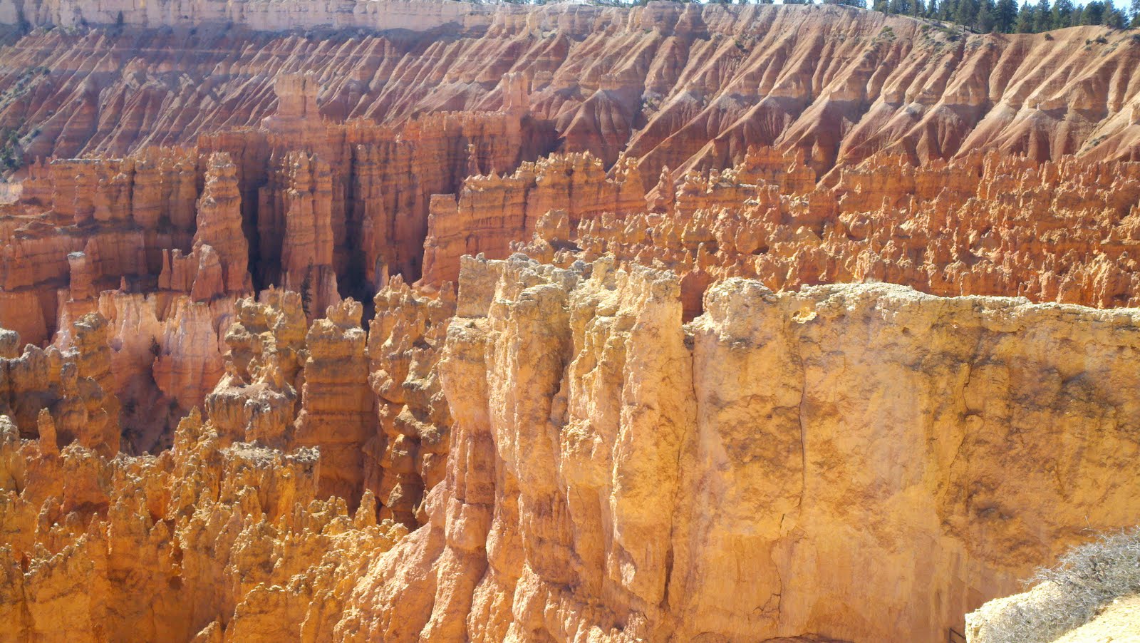
The first thing I did when I arrived in Salt Lake was to drive up Little Cottonwood Canyon to see how the snow last night affected the Snowbird and Alta ski resorts. Temperature wise, it was a mild day in the valley but it quickly cooled to the low 30s on my way to the resorts and cars coming down the canyon road in the opposite direction had almost a foot of snow on their roofs. I love the feeling of being in the mountains in winter. Tall snow covered mountains, blue skies and trees flocked in a heavy white. Even though the ski season doesn’t officially start until late November, there were plenty of skiers in the parking lot willing to skin or hike their way up to the top for the reward of being able to make perfect and solitary turns in knee to waist deep fresh snow, away from all of the people that the regular season brings.

It was now lunchtime and there is a place that I seek out every time I come to SLC, the Lone Star Taqueria. Lone Star makes some of the best fish tacos that I’ve ever had. They start with lightly fried Cod placed on two white corn tortillas and then top that with cabbage, tomato and onions and a wedge of lime. On the side is a small container of a mayo based sauce that has a late, mild heat of jalapeno peppers. It’s quite simple but just the right combination of flavors. Pair that with a DOS Equis and you’ve got one helluva meal!

From there, I drove Interstate 80 to have a peek at Park City and The Canyons. Not quite as much snow as in Little Cottonwood Canyon but snow nonetheless. I stopped in at Wasatch Brewery on Main Street in Park City to sample a Polygamy Porter. With a slogan like “bring some home for the wives”, I thought it was only fitting to try one while in Utah.

I arrived at Eric’s house just in time for dinner and to meet his fiance Laura. Eric also had an ex-coworker from NJ over for dinner as well. She was in town to do research on her family tree at the Family History Library, the largest genealogy database in the world. We stayed up until around midnight catching up on the past 20+ years.

Thursday, October 28th, 2010

I got some laundry going in the morning and I dropped off my car to have the oil changed, the second time in less than two months. Eric and I drove up into Big Cottonwood Canyon to see some more snow at Solitude and Brighton. Eric really has a passion for skiing. We pulled over along side of this one road and we passed the binoculars back and forth as he was pointing out some of the places that he had gone backcountry skiing, and at the same time he was scoping out new spots. Some of the chutes and bowls he is riding gave me the willies just thinking about what it would be like looking down on some of these runs with your ski tips dangling out into the air. I’m definitely not at his level of skiing, but should get a lot closer with a full season under my belt. We grabbed some lunch at a diner and just hung out for the rest of the day. We cooked up some of the best burgers I’ve had for dinner. They were Rufus burgers. Rufus was a deer that Eric “acquired” last month and this guy was delicious! After dinner, Eric, Laura, myself and their friends Floyd and Lisa went out for a couple beers at the Hogwallow bar to watch some live music. All in all, a good day.

Friday, October 29th, 2010

I took my third shower in three days this morning which might be a record. I hung out for a while and then unloaded a portion of the trunk before repacking it again to put some order and organization back to my car. It’s easy to pull things out of bags and toss them around when in a hurry, but when you’re living out of a car, disorganization quickly leads to frustration.

I drove a little over four hours today, straight up I-15 North and am currently in Idaho Falls relaxing at a Barnes & Noble. It’s a bit of a weird place and I’m not talking about the bookstore. I met someone while riding in Moab who said I wouldn’t miss anything if I didn’t check out Idaho Falls, she was absolutely correct. I don’t know if I’m going to stay here tonight or just get back on the road? I don’t need any more weirdness rubbing off on me.

Anyway, here’s my shout out to Eric and Laura for letting me crash with them. I had a great time and hopefully I get a chance to ride some deep stuff with them this winter!

Salt Lake City has probably moved into first position for possible relocation, for several reasons. The proximity to so much great skiing is hard to beat anywhere. House prices are the most reasonable so far. SLC has probably the best prospects for landing a job and I have two great contacts there already.

Tuesday, October 26, 2010

Day 46 - Bryce Canyon, Utah

Tuesday, October 26th, 2010

Map of Bryce Canyon

Last night I entered Bryce Canyon National Park at around 9pm. The sign at the gate said that there were campsites available at the north campground. When I got to the campsite entrance, I got out of the car and picked up a reservation envelope. It was cold and there was already snow on the entrance sign. Picking a campsite works by way of the honor system. You take an envelope and proceed to find an empty spot that you want for setting up camp. The you write down information on the envelope like your license plate #, which campsite you chose and how many nights you plan to stay. Put cash or a check in the envelope ($15/night) and return to the entrance to place the envelope in a locked box. Before placing the envelope in the box, tear off a stub and place it on the post in front of your campsite. I chose my campsite but since it was getting late and was quite cold already with a chance of snow, I slept in my car.

When I woke up, my windows were frozen on the inside from my respiration. The temperature dropped down to 26F so it was a little chilly, even in the car. Apparently, Bryce Canyon because of its location and high altitude has 200 days of below freezing temperatures. It’s actually one of the highest areas in the Colorado Plateau. I turned on the heat to defrost my front and rear windows and then proceeded to the visitor’s center to get a map of the park. I drove to Bryce Point at the end of the park and figured that I would work my way back. I hiked the Bryce Point trail which connects to a looped trail named Peekaboo and then exits via the same Bryce Point trail. The entire hike was an easy five miles on smooth trails. It started at the top with a spectacular view looking down on the amphitheater of fins, spires, ridges, pillars, balanced rocks and hoodoos. The Paiute Native Americans believed the hoodoos were actually people that were turned to stone by coyotes with magical powers. The trail meandered back and forth, just like any other trail working its way down the side of a steep mountain side. Once at the bottom and looking up, these formations took on a completely different perspective. I would compare it to taking a helicopter ride to view the NYC skyline and then walking the streets and looking up at the same tall buildings from the ground. The landscape here is different like no other. There are thousands of these strangely formed, almost unlikely and improbable structures jutting straight up from the ground like flagpoles. In reality, it’s just a natural process of erosion by wind and water that slowly breaks apart the rock, one pebble, stone or boulder at a time. This canyon is a delicate one and always in the process of changing. Even though I was only there a short time, it was not uncommon to see small pieces of rock dislodge themselves and roll downhill across the trail in front of me. Some trails were closed due to rock slides. Not only were the formations fascinating but the colors seemed to be amplified by the sun. There were various shades of reds and grays, alternating in their horizontal layers. The red colors come from the presence of Iron and other trace minerals. The grays appear from the limestone layers and from the absence of Iron. Iron being the heaviest of the elements, filters out of the rock more quickly than the others, taking with it its red color, of course over millions of years. There are also other elements like Manganese and Magnesium which contribute some hints of blues and greens. As I was walking out of the canyon, the sun hit the rocks in such a way that it turned some of them bright orange, almost as if they were somehow illuminated from the inside. There were more trails to hike and other observation platforms to see Bryce Canyon from, but even as spectacular as these formations were, it was my opinion that they are all just different variations of the same thing. I spent about six hours here and then decided to move on.

I pulled out some maps and planned on heading in the direction of Salt Lake City. Most of the drive was pretty uneventful. I passed through small town after even smaller town, all having the look of being stuck forty years in the past. I could see snow caps off in the distance. I was a bit tired and didn’t feel like driving the 260 miles all at once so I'm going to try to find a place to crash somewhere between Provo and Orem. The good thing is that many of the mountains are already almost completely covered in snow!

Tomorrow I’ll make it the rest of the way to Salt Lake City. I know of a place that serves great fish tacos! Someone from Barnes and Noble just said it was snowing outside so I went out for a look. Snow and fish tacos tomorrow, what could be better?


Monday, October 25, 2010

Day 45 – Observation Point, Zion National Park

Monday, October 25th, 2010

The site I found by the river last night was perfect, and free. It rained again last night. I’m starting to think that it rains every night here. It didn’t stop until around 9am and then the sun came out from behind the clouds. I got my stuff together and drove about nine miles back to the South entrance of Zion. It’s a $25 admission fee to get into the park, so the $80 Annual National Park Pass that I purchased at Badlands, SD has already paid for itself and then some. Once I got back inside the park it started raining again. I thought about scrapping the idea of hiking today as I sat in my car trying to figure out what the weather was going to do. I figured it would be a waste not to hike while I'm here so I grabbed my raingear and went to the shuttle stop. Luckily it stopped raining for good about five minutes later.

I only did one hike today, the Observation point hike via the East Rim Trail. It was a total of eight miles with an elevation gain of 2,148’ and is accessed from the Weeping Rock shuttle stop. About a mile into the trail I came across a section in Echo Canyon that was difficult to traverse because the depth of the stream had risen from the rain, so I had to scale a sloping wall of rocks to get through. I got about half way through and then backtracked to rethink my approach. Portions of Echo Canyon are slot canyons and the wind here quickly went from a steady, soft breeze to 30-40+mph. It was here where I met Carsten from Heidelberg, Germany. Together, we planned a route to get across the water. We ended up hiking the rest of the seven miles together. Carsten came to the US to attend a technology conference in Las Vegas and was spending a few days hiking around Bryce Canyon and Zion before he returns. Overall, the Observation Point trail was a relatively easy hike. It had a few steep sections but for the most part it was a gradual incline on mainly paved trails. Along the trail there were more steep drop-offs, great views the entire way up and lots of waterfalls, one of the benefits from all of the rain the past few days. From the top were panoramic views out over Zion Canyon, and across the way you could see Angels Landing. All in all, it was a nice hike but after just having done Angels Landing the day before, it would be hard for any trail to receive higher marks.

Leaving Zion, I drove out the south side of Zion park on the Zion-Mount Carmel Highway (Utah Highway, U-9), a 14-mile long scenic byway that exits out of the east side of the park. I set my GPS to Bryce Canyon and continued east on U-9 and then north on US-89. There weren’t many people living between Zion and Bryce but I did see my share of animals. I passed by fields of cattle, buffalo, horses, llamas, donkeys, elk and Texas longhorn.

I drove past the turn that lead to Bryce Canyon after I saw a sign for Subway’s $5 footlongs and free wi-fi in Panguitch, UT, about seven miles out of the way. I don’t get to eat a lot of vegetables on the road, so between being able to load up a sandwich with tomatoes, peppers, onions and pickles and not having to write my blog from the front seat of a Subaru, Subway was a fine detour. The town of Panguitch encompasses only 1.4 square miles and I think I’ve seen every one of its residents come through this Subway, all dressed in camo with hunter orange vests and hats. The temperature is now in the 40s and snow can be seen off on the mountain tops. The girl behind the Subway counter said it snowed here last night and it is supposed to snow again tonight. It’s about time!

Sunday, October 24, 2010

Day 44 – Angels Landing - Zion National Park, Utah

Sunday, October 24th, 2010

Here's a link to a map of Zion National Park.

I hopped on board the free shuttle this morning around 9:30 and rode it to the Grotto stop. This stop along the six mile canyon road provides access to the Grotto and Kayenta trails, both of which I did yesterday, and the most well known trail at Zion National Park, Angels Landing. Angels Landing was closed yesterday for repair work so today was my chance to see it for myself.

Today was mostly overcast and fairly cool, in the upper 50s. An extra layer of clothing was needed this morning but it was quickly shed once I began walking. The Zion brochure ranks Angels landing in the strenuous hike category with a total round trip distance of 5.4 miles and a 1,488’ elevation gain. This trail probably gets its notoriety from the amazing 360 panoramic views at the summit but also because of the many lives that have been lost here, the most recent being this past April. It’s a plenty safe hike to do if you are careful and aware of your surroundings; however, some people unfortunately are not.

The trail is fairly steep but it’s paved a good portion of the way. It zig-zags back and forth as it winds its way up the high rock walls. There is one section called Walter’s Wiggles where the trail switchbacks 21 times, with not more than 20 paces before it again changes direction, almost 180 degrees. After Walter’s Wiggles, the next significant milestone is Scout Lookout. This is where many people, even with the best intentions of summiting Angels Landing, have their first peak at what lies ahead and decide to turn around. The end of Angels Landing is only 0.5 miles from Scout Lookout, but it is also the most challenging. The path to the top at 5,785’ is littered with obstacles such as boulders to maneuver over and around, slippery sandstone slopes and narrow paths, in some places only 3-4 feet wide, separating you from 1,200’ near vertical drop offs on either side. In recent years, trail crew have installed heavy gauge chains as a safety device in some of the more dangerous sections, even still, this is not for anyone fearful of heights.

I made it to the top and it wasn’t as bad as some people have made it out to be. I videotaped the last 0.5 miles from Scout Lookout to the top of Angels Landing so hopefully sometime soon I will have access to a fast internet connection to upload the file. It was definitely a trail worth hiking and just about anyone can do it if they’re careful and they don’t get freaked out by being on the edge of some very steep cliffs.

I decided to only do one hike today. After Angels Landing, I drove back to the town of Hurricane which I passed through on my way from Vegas to Zion. I remembered a Wal-Mart being there and I was running low on supplies. Things like batteries, energy bars, cookies, peanut butter and crackers, cans of chili, pudding, you know, all the good stuff that doesn’t go bad without refrigeration. While driving to Wal-Mart I found a public grounds area where I saw a few tents set up so I will go and check that out later tonight. It looks a little sandy but there are plenty of trees and it’s right on the edge of the river.

Tomorrow morning I am planning on doing the Observation Point trail via the East Rim trail. It's eight miles and should take about five hours. After that I think I will be on my way to Bryce Canyon.

Saturday, October 23, 2010

Day 42 & 43 – Las Vegas, NV to Zion National Park

Friday, October 22nd, 2010

Not too much to update on today. I woke up in Vegas not feeling too well. Not because of the alcohol consumption from the night before but because I think I’m developing a head and chest cold. I was feeling good all night except towards the early morning hours when I noticed my voice starting to go. I thought it was just dehydration but unfortunately I don’t think so anymore.

I left Las Vegas around 11am and jumped on I-15 heading north in the direction of Zion National Park. It was just a little over 160 miles and most of it was on I-15. It took me through Mesquite, NV, quickly in and out of Arizona passing through the north western corner of the state and then back in to Utah and the mountain time zone. I stopped in the town of Washington, UT just for a break since I was feeling rundown. I found a Barnes and Noble that was attached to a mall so I spent a few hours there, just to relax. I had searched what was in Washington and it just so happened that there was an IN-N-Out burger about a mile down the road. For dinner I stopped in for another “double double” with fries and a chocolate shake which I thought would feel good on my throat. It sure did. It started raining shortly after I left the IN-N-OUT and it rained the rest of the way to Zion. I got there after dark and parked in the far corner of the overflow parking lot to call it a night. Even though it was raining, there was enough moonlight to see that I was near the base of some very tall mountains and I knew this visit to Zion was going to be great.

Saturday, October 23nd, 2010

I got almost 11 hours of sleep last night. It was still raining and I still felt like crap. Today was going to be a day to take it easy. I knew I was in for a treat today when the first thing I noticed were these gigantic mountains surrounding me and their tall peaks covered by the storm clouds overhead.

Zion National park covers 229 square miles and is located in the southwestern part of Utah, at the junction of the Colorado Plateau, Great Basin and Mojave Desert. I made my way over to the visitor’s center where a free shuttle transports people back and forth along the six mile canyon road. There are no cars allowed except for those staying at the lodge. The trail that I really wanted to hike today was called “Angels Landing” but unfortunately it was closed today for repair work, but that was ok because a park ranger advised against hiking that particular trail when it’s raining anyway.

I did a series of three hikes today. The first one was a three mile hike on the Kayenta – Emerald Pool loop. This trail started at The Grotto stop and ended at the Zion Lodge. This trail leads you up to an amazing waterfall that collects in what is called the Upper Emerald pool. The overflow from this pool forms another waterfall that collects in another pool below. Beautiful views!

The second hike was on the Hidden Canyon Trail, starting at the Weeping Rock shuttle stop. It is a 2.2 mile roundtrip hike along steep, sheer cliffs. I added on an additional 2.2 miles by continuing on past where the trail is no longer maintained. This is where the canyon narrowed and some climbing and a lot of bouldering were required. I got as far as I could go before reaching a point where I was risking injury and/or falling into a deep pool of water. Great hike to get to a place where no one is around.

The last hike of the day was an easy, mostly paved trail but offered some fantastic scenery. This was the Riverside Walk located at The Temple of Sinawava stop. It is called the Riverside walk because the path runs parallel to the Virgin River. This was a two mile roundtrip hike with hardly any elevation gain and was an easy hike to finish the day. There were more waterfalls, wildlife and hanging gardens of plants growing on the steep, porous canyon walls.

I was only planning on staying for a day and then moving on to Bryce Canyon. Zion exceeded my expectation so much that I will spend another day or two. The hiking is fantastic. The views are spectacular. The canyon walls are so tall, steep and nearly vertical that you have to look almost straight up to see the tops. Down in the valley, nestled between these incredible walls of sandstone is a forest with lots of wildlife. The river and all of the waterfalls keep everything below green. It definitely does not feel like a desert here.

This was only my first day at Zion National Park but already I feel like I have to add this to the must see category of places.

Tomorrow is Angels Landing. Hopefully I’m feeling better by then.

Friday, October 22, 2010

Day 41 – Hoover Dam and Las Vegas, NV

Thursday, October 21th 2010

In the morning I drove back along US-93 to see the Hoover Dam. I had driven past it the night before but I wanted to see it in the daytime. Hoover Dam is a massive concrete arch-gravity dam controlling the flow of water from the Colorado River. The dam rests on both sides of the Arizona and Nevada state line. It was built during the years of 1931-1936 for the purpose of controlling floods, providing irrigation and to produce hydroelectric power. It is 1,244 feet long, 726 feet tall, 660 feet thick at its base and generates 4.2 billion KWh annually, supplying power to public and private utilities in Nevada, Arizona and California. It’s a remarkable structure and worthwhile seeing.


From the Hoover Dam, I drove about 30 miles to Las Vegas. I arrived around noon and drove the main strip. The strip was full with people as I’m sure it always is. Kevin was staying at the Mirage and he offered the extra bed in his room to me for the night so I parked near his hotel. I met up with Kevin and Graeme around 2pm as they were taking a quick lunch break from the show. After that, I went out to walk around and check out the sites. Vegas is an interesting place. It has an “anything goes” type of vibe to it. Everyone seemed to be drinking in public so I decided it would be best to try to fit in with the crowd. I went to a few casinos to take advantage of their drink specials. I passed a little person dressed in a leprechaun outfit outside of the O’Sheas casino, part of Harrahs. He was advertising a beerpong tournament that was about to start in twenty minutes. The entrance fee was $20/person and a prize of $200 awaited the winning team. I tried to coax Kevin via a text to leave the show early and be my partner in the tournament but he couldn’t. I knew he wouldn't be able to but it was my only option. I really wanted to play. I sampled a few more beers at some other casinos and then stopped at a Chipotle for a Baracoa burrito. I figured this was going to be a long night and I had better get some food in my stomach. I went back to O’Sheas to watch the tournament in progress. Although I didn’t get a chance to compete in the tournament, I did meet someone who asked if I would be his teammate in a few pickup games. We went three games undefeated before I had to leave to meet back up with Kevin and Greame. If only I had met this guy earlier in the day, I think we would’ve had a chance at that $200 pot!

After some time walking on the strip, we all decided to take a taxi to Fremont Street in downtown Vegas. Fremont Street is the older section of Las Vegas and this was my first time there. It is an actual street outside but it is covered overhead with a giant canopy of neon lights and video screens, making the night as bright as day. It was full of people, girls dancing on tables, bands and street performers. I definitely prefer this area compared to the well known Vegas strip. We had some dinner, drinks and tried our luck at some tables. Graeme had a nice run going playing roulette and then we went to the blackjack tables. The dealers slowly depleted our chip stacks. Kevin and Graeme had gotten up from the table and I was down to my last chip. I pulled two eights, which I split, then split again and then doubled down, making back my money to break even.

From there we walked a few streets over to the Hogs and Heifers Saloon. This is a well known biker bar bereft of all of the glitz and glamour of the typical Vegas bars. Here, bras and bumper stickers adorn the walls and good looking bartenders intermittently break from pouring beers to dance on top of the bar, all the while putting patrons in their place with the use of a bull horn. It was great! We stayed for a few rounds and then things started to get a little fuzzy. I guess I’ll just have to end this post here and stay true to the Vegas motto.

We had fun.

Thursday, October 21, 2010

Day 40 – Grand Canyon to the Hoover Dam

Wednesday, October 20th 2010

It rained again all night but I stayed nice and dry in my car after hiking back out of the Grand Canyon. I’ve been very lucky so far, not getting caught outside in any bad weather overnight since I left NJ. I suppose by writing that fact down in internet ink, I just about guarantee myself a sleepless night in a heavy rainstorm, inside a leaky tent, sometime in the next few days.

I got in touch with a friend of mine from FMC today. Kevin was going to be flying into Las Vegas to work booth duty at Supply Side West, a large event for ingredient, flavor, technology and service providers. He was scheduled to arrive sometime around midnight. Before I left on my trip we talked about how it would be great if we were both going to be in Las Vegas at the same time. Lucky enough, it turns out that our schedules synced up perfectly. Kevin and I were in Las Vegas for a conference about 12 years ago but unfortunately I can’t talk about that. You know the motto “what happens in Vegas, ………..”. Let’s just say we had fun. Our boss Graeme is also attending Supply Side, but he’s flying from Belgium, so the nine hour time differential might be causing some ill effects on him. Anyway, now that the next leg of my trip is set up, I’m excited to see these guys and I’m sure we’ll have some interesting Vegas stories to share, amongst ourselves that is.

I left the Grand Canyon area sometime around noon. On the way out of the park, I saw a couple of large, multi-point mule deer and two elk foraging for food. I made my way south, back in the direction of Flagstaff on US-89, en route to Las Vegas, NV, roughly 330 miles away. About twenty minutes before reaching Flagstaff, I came across my first encounter with snow on the road. I thought it was odd to see a snow plow driving in my direction only a few minutes prior. I had checked the outside temperature gauge on my dashboard and it was still 50F. Sure enough though, within two minutes I drove over a thin covering of snow on the road that only lasted about a mile. It must have been a small, concentrated weather pattern formed by the mountains nearby. Shortly after that, the sun came out and then quickly was covered up by dark thunderstorm clouds, followed by a strong hail storm. I took cover under an awning at a remote country store / gas station. This was some of the wackiest weather that I’ve ever encountered, all within a 10-15 minute time frame!

I headed west on I-40 and made it about as far as I could go without running out of gas as I was too stubborn to refuel at $3.39 near the Grand Canyon. I came across a truck stop in Williams, AZ to fill up at $2.79 and paid $10 for a much needed shower. I was back on the road and feeling refreshed but it was only about to get better. In another two hours I would approach the town of Kingman where I saw a sign for an “IN-N-OUT” Burger. I have been wanting to eat at one of these for far too long. I thought this was a chain only available on the west coast but my Uncle Phil alerted me to the possibilities that I could run into one in Arizona. My heart almost skipped a beat as I prepared to pull off at the next exit with the red, white and yellow sign just visible in the distance. I ordered the “Double Double” (double beef patty and double cheese), french fries and a chocolate shake. I’m a believer!

With a clean body and satiated appetite I turned north onto US-93 in the direction of Las Vegas. Along the way I noticed signs for Hoover Dam which is basically the border of Arizona and Nevada. I had never seen the Hoover Dam but it was already dark so I continued on across the border and stayed the night in Boulder City, NV, about 10 miles north of the Hoover Dam. I would backtrack to the Hoover Dam in the morning and then make my way to Las Vegas to meet up with Kevin and Graeme.

Mileage Update: 5,340 miles

Wednesday, October 20, 2010

Day 38 & 39 - Grand Canyon, AZ

Monday & Tuesday, October 18th-19th 2010

I arrived at the Grand Canyon a little after 11pm and headed directly to the Backcountry Information Center and found a spot in the parking lot to get some rest. The office opened at 8am so I set my alarm for 7:15 to give me a good shot at being first in line. It had rained all night and the forecast was for possible thunderstorms for the next five days.

Monday, October 18th

I woke up before my alarm and waited outside the office for an hour before they opened. Once inside, I inquired about a permit but none were available until the following day. There were about 15 people behind me, also hoping to get a permit. On my way out the door, a man and women walked in and asked if anyone wanted to buy their permit for today. I immediately grabbed it.

I happily walked back to my car, permit in hand, and started to pack my backpack. I was going to take the South Kaibab trail from the South Rim (elevation 7,200') to the bottom of the Grand Canyon, staying overnight at the Bright Angel Campground (elevation 2,400'). In order to get to the trailhead, I took a free shuttle from the Backcountry Information Center to the Visitor’s Center. From there, another shuttle to the South Kaibab trail. I started the hike at 10:15am. The South Kaibab route is a 7.1 mile trek downhill through steep and rocky terrain. The hike along the switchback trails offered amazing views the entire way down. It looks as if it is actually a canyon within a canyon, inside of another canyon with several layers of mesas, or shelves which drop off into another lower level. At some points along the trail, you can see 360 degrees around, taking in all the colors of the Kaibab, Mauv and Redwood Limestone and the Cococino and Tapeats Sandstone. After a few miles down, the Colorado River would begin to reveal itself, greenish and turbid from the recent storm. The majority of the trail was how I imagined it to be, rugged and dry with occasional small brushy plants and few trees here and there. About a mile or so from the campsite, the Kaibab suspension bridge enables hikers and mules to cross the river. Finally, the last mile was pretty flat to the campsite. The steepness and uneven trail over the last six miles were really taking a toll on my knees. I’m sure it didn’t help that I was carrying a 40lb pack, 15 of which was from my tent, poles and rainfly, made more for car camping than hiking. I will be looking for a smaller, lighter tent in the next few days. After crossing the Colorado River, the trail meandered along a new, flourishing habitat of tall trees, all types of grasses and vegetation, lots of wildlife and the roaring sound of the fast flowing Bright Angel Creek. I reached the campsite in a little over 4 hours and chose a site about 15 yards from the creek. I immediately set up camp, washed up in the creek, kicked off the boots and napped for an hour or two. After giving my legs a rest, I hiked around a bit more before dinner. I filtered some water from the creek and made some chicken and rice with a side of a blueberry Cliff bar and beef jerky. There were some dark clouds coming in over the canyon accompanied by a lightning show so I put up my rainfly as a precaution. Lights out at 8pm.

Tuesday, October 19th

My tired body slept well last night. There was some thunder and lightning but not a drop of rain. I took my time getting started this morning. I was going to take the Bright Angel trail back up to the South Rim and my sore legs weren’t too excited to begin the 9.3 mile hike uphill. By the time I got going it was around noon. Even though the Bright Angel trail was two miles longer than the South Kaibab trail I walked down yesterday, I thought it would be nice to get a different view, and the linear rise of the slope should be a little easier on the knees. Fortunately, about 90% of the hike was in the shade, with the tall, nearly vertical walls offering protection from the sun. The first two miles tracked close to the Colorado River before turning inward toward the canyon. The next three or so miles were along waterfalls, creeks and streams. The water gave the necessary nourishment to the park-like setting, very different than the dry and dormant environment that I had anticipated. The two trails differed in that the South Kaibab offered more “wow” vistas of the enormous canyon and the Bright Angel trail seemed more enclosed by canyon walls but with more differing landscapes. As is always the case, the last several miles were the hardest. I found myself eating more food and drinking more water just to lighten up my pack. At times I thought about ditching my tent, not seriously though, knowing that I was going to buy another one soon. I took my time, as my legs and knees were still sore from the day before. I met a guy from Telluride, CO and hiked most of the day with him. If you’ve been reading the blog, you know how I feel about Telluride and now I have a solid contact there! We made it back to the top of the South Rim, walking the last hour in the light of the moon that would be full in three more days. Once at the top, I had another ½ mile to get back to my car. I was bushed and it felt so good to get that pack off my shoulders. I decided to sleep right where I started in the Grand Canyon, in the parking lot next to the Backcountry Information Office. Dinner was a Cliff bar, dried apples and some fruit chews. After two days and 16+ miles, I was ready for sleep at 7:30pm.

Besides seeing all of these amazing places during my travels, I am really enjoying meeting some wonderful people. Here’s to Tim from Telluride, CO, Kent from San Diego, CA, Coline from France and Natalie from Switzerland for sharing their time and some stories along the way!